

Featured image: the southern Baltic Sea seen by NASA’s Aqua satellite, May 19, 2017. Image: Jeff Schmaltz, MODIS Land Rapid Response Team, NASA GSFC, public domain, via Wikimedia Commons.

The Baltic Reality | Part 2 of 5
By Eva Sula
Editor’s note: This is Part 2 of Eva Sula’s five-part series The Baltic Reality: Beyond the Red Arrows. BISC added the maps and the photographs. They are not part of her original article, which appears here as she wrote it.
All opinions expressed are those of the author alone and may not represent those of the institutions they represent or the Baltic International Security Centre (BISC). BISC maintains a strict intellectual independence policy across all its projects and publications.
© Eva Sula
First published on LinkedIn on July 24, 2026. Read the original article or the LinkedIn post.
Introduction
Part 1 of this series examined why political borders and simplified movement arrows do not explain military geography. Terrain, water, infrastructure, seasonal conditions and local knowledge shape what military forces can do long before capability numbers or reinforcement timelines become relevant. Part 2 widens the frame. National borders do not contain the consequences of disruption, and the Baltic States cannot be understood as three isolated territories positioned beside Russia.
The Baltic region functions through a network of maritime routes, ports, airspace, railways, roads, energy connections, communications infrastructure and political arrangements extending well beyond Estonia, Latvia and Lithuania. A harbour closure in Sweden, damage to an undersea cable between Finland and Estonia, restricted access through the Danish Straits or reduced operating freedom around Gotland would not remain local problems. Each could affect commercial shipping, military movement, energy supply, communications, situational awareness, industrial activity and political decision-making elsewhere in the region.
This raises four practical questions that should precede any discussion of reinforcement or regional defence. Where does the Baltic theatre actually begin and end? Which geographic locations influence access, movement and sustainment across the region? Which civilian systems also support military readiness and reinforcement? Who holds the local and technical knowledge required to determine whether regional plans can function under pressure?
These questions are necessary because the Baltic Sea is not empty space between national territories. It is an operating environment containing commercial shipping lanes, ferry networks, naval routes, ports, air corridors, energy links, data cables, offshore infrastructure and densely used coastal areas. The Gulf of Finland connects Estonia and Finland while also affecting access to the eastern Baltic. Gotland influences surveillance, air and maritime activity across the central Baltic. The Danish Straits connect the Baltic Sea to the North Sea, while ports and logistics networks farther west support the movement of forces, supplies and commercial goods into the region.
Regional interconnection creates options, but it also creates dependencies. A ferry route may support normal trade, civilian movement and military transport, yet its disruption can create shortages while removing a reinforcement option. A port may provide strategic access, but only if it has sufficient capacity, protection, handling equipment and onward connections. A communications cable may improve redundancy until several systems depend on the same landing site, repair vessel, legal process or commercial operator. Connectivity increases resilience only when alternatives are known, available and exercised.
The same distinction applies to alliance planning. Membership, agreements and infrastructure do not automatically create operational access. Forces still require political approval, transport capacity, host-nation support, fuel, ammunition, communications, maintenance, protection and functioning routes from arrival points to their intended areas of operation. Civilian authorities, commercial operators and infrastructure owners therefore form part of the same regional system as military commands, even though they operate under different mandates and priorities.
Geography creates these relationships, but geography alone does not determine whether they become sources of resilience or points of failure. That depends on planning, governance, investment, interoperability and the quality of knowledge available to decision-makers. Part 2 examines those dependencies across the Baltic Sea, the Gulf of Finland, Gotland, the Danish Straits, the North Sea and the wider northern European theatre.
Section 1. The Baltic Theatre Is Larger Than the Baltic States
Estonia, Latvia and Lithuania are often presented as the complete Baltic security problem because they occupy the eastern edge of the Baltic Sea and share borders with Russia or Belarus. That framing is useful for showing political geography, but it is insufficient for understanding defence, reinforcement and regional continuity. The relevant operating environment extends through Finland and Sweden, across Poland, Denmark and Germany, into the North Sea logistics network, and northwards through Norway, the United Kingdom, Iceland and the North Atlantic.
This larger geography is not an attempt to dilute the particular security concerns of the Baltic States. It is necessary because forces, fuel, ammunition, commercial supplies, energy, data and political decisions do not move within isolated national systems. They pass through ports, territorial waters, airspace, railways, roads, communications networks and legal jurisdictions distributed across the region. Disruption in one location can therefore remove options or impose costs elsewhere, even when no national border has been crossed.
The countries the Baltic theatre runs through
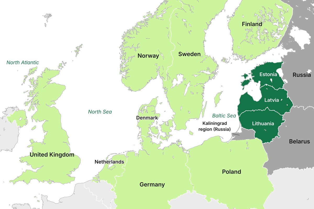
Map: BISC. Borders: OpenStreetMap contributors.
1.1 From National Maps to a Connected Theatre
The security of Estonia or Latvia cannot be understood solely by looking eastwards. Their ability to sustain national defence and receive allied support depends partly on access through countries that may appear peripheral on a political map but perform essential operational functions.
Denmark and Germany connect the Baltic region to western European ports, railways and road networks. Sweden occupies much of the Baltic Sea’s western side and provides territory, ports, airspace and infrastructure close to the Baltic States. Finland shares the Gulf of Finland with Estonia and connects the Baltic operating environment to the wider Nordic and Arctic region. Poland provides the principal land connection between the Baltic States and the rest of NATO territory, while its ports, transport infrastructure and industrial capacity support a much broader range of reinforcement and sustainment options.
Farther west, North Sea ports in Germany, the Netherlands and the United Kingdom form part of the strategic movement system through which personnel, equipment and supplies may arrive from Europe or across the Atlantic. Norway and the United Kingdom connect the Baltic region to the High North and North Atlantic, while Iceland and the Greenland-Iceland-United Kingdom area remain relevant to the protection of transatlantic sea lines of communication. NATO’s Joint Force Command Norfolk is responsible for safeguarding those strategic Atlantic connections, and the Alliance has increasingly aligned Nordic defence planning with that wider northern maritime geography.
The operational question is therefore not simply which states border the Baltic States. It is how people, materiel, information and political authority move through the wider system, and where interruption in one part changes the options available elsewhere. A delayed shipment in a North Sea port, constrained access through Denmark, disruption to Swedish airspace or damage to infrastructure in the Gulf of Finland can affect military readiness and civilian continuity hundreds of kilometres away.
This also explains why regional dependencies cannot be assessed only during crisis planning. Commercial transport schedules, port ownership, railway capacity, customs arrangements, fuel distribution and communications services are primarily organised for peacetime efficiency. Their availability for defence purposes depends on prior agreements, legal authority, protection, workforce availability and the capacity to absorb military demand without collapsing essential civilian functions.
1.2 The Baltic Sea, High North and North Atlantic Are Connected
The Joint Expeditionary Force provides a useful institutional illustration of this geography without defining the entire regional architecture. Its ten participating states are Denmark, Estonia, Finland, Iceland, Latvia, Lithuania, the Netherlands, Norway, Sweden and the United Kingdom. They do not form a coherent group merely because they are culturally similar or geographically adjacent. Their security interests overlap across the Baltic Sea, High North and North Atlantic, where maritime access, infrastructure, reinforcement routes and hybrid pressure cannot be separated neatly into national compartments.
At their March 2026 summit, JEF leaders described the Baltic Sea region, the High North and the North Atlantic as a single interlinked geostrategic area. They also identified the JEF’s role as a bridge between national and NATO operations and during the transition from crisis to conflict. That language reflects the practical reality that an incident may begin under national legal authority, require regional consultation and capability support, and later become part of a wider NATO response.
The High North matters to Baltic security because northern air and maritime activity affects NATO’s ability to protect reinforcement routes and maintain situational awareness across the wider flank. The North Atlantic matters because European defence still depends upon the secure movement of forces and supplies across the ocean. Denmark matters because access between the Baltic and North Sea passes through or alongside Danish territory and waters. Sweden and Finland matter because their geography shapes operations across the central Baltic, Gulf of Bothnia and Gulf of Finland. Poland and the Baltic States form the eastern part of this connected system, but they are not operationally detached from what happens farther west or north.
This wider perspective also helps explain why Finland’s and Sweden’s NATO membership changed more than the political map. Their accession brought national territory, military infrastructure, regional expertise and existing Nordic cooperation more fully into Alliance planning. NATO now treats Arctic and northern European security as increasingly connected, including through the alignment of Denmark, Finland and Sweden with Joint Force Command Norfolk’s area of responsibility.
The Baltic theatre consequently begins well before a force reaches Poland or enters the Baltic Sea. It includes the Atlantic routes used to reach Europe, the North Sea ports where equipment may be unloaded, the Danish approaches through which maritime traffic passes, the Swedish and Finnish spaces that shape regional access, and the infrastructure required to move onward from ports and airfields to operational areas.
1.3 Historical Continuity Without Historical Determinism
Regional interdependence is not a product of NATO enlargement or modern logistics. Baltic trade, access to ports and control of sea routes have shaped the balance of power in Northern Europe for centuries. Denmark-Norway, Sweden, Poland-Lithuania, Muscovy and later Russia competed for influence over the Baltic because grain, timber, hemp, flax and other strategically important goods moved through its ports and waterways. Control of places such as Riga, Danzig, Elbing and Stettin brought economic influence, access to maritime trade and the means to support military power.
The Great Northern War demonstrated how widely this geography connected military events. The conflict involved Sweden, Russia, Denmark-Norway and Saxony-Poland-Lithuania, while campaigns around Narva, Riga, Poland, Denmark and the Swedish mainland formed parts of the same struggle over regional power and Russian access to the Baltic. Russia’s eventual victory provided Baltic ports, supported the establishment of Saint Petersburg and shifted the balance of power across Northern and Eastern Europe.
The world wars widened the same dependence through industrial logistics, railways, mines, blockades, submarines and long-range naval operations. Control of North Sea shipping lanes enabled Britain to sustain its blockade of Germany during the First World War, while the Battle of Jutland off Denmark illustrated how events outside the Baltic proper could influence access, trade and strategic freedom across Northern Europe. During the Second World War, Atlantic and Arctic convoy routes connected British and Icelandic waters to the supply of the Soviet Union, demonstrating that northern maritime logistics could link distant theatres while remaining exposed to weather, mines and hostile action.
These examples do not provide a template for a future conflict. Political structures, technology, alliances and military capabilities have changed fundamentally. They do show that campaigns on land have repeatedly depended upon access to ports, control of maritime routes, functioning transport networks and the ability to sustain forces across a wider region.
Modern sensing, cyber operations, long-range weapons and undersea infrastructure have expanded the space in which these dependencies can be observed, disrupted or protected. The underlying requirement remains familiar: regional defence depends upon access, movement, information and sustainment across a theatre that is considerably larger than the Baltic States themselves.
Section 2. Water Connects the Region and Creates Exposure
Part 1 examined water primarily as military geography. Rivers, lakes and coastlines influence military mobility and shape the terrain in which operations take place. At the regional level, water performs a different but equally important function. The Baltic Sea is not merely a body of water separating states. It is a network that connects governments, industries, infrastructure, military forces and civilian populations across Northern Europe.
Commercial goods, military equipment, passengers, fuel, electricity and data move across or beneath the Baltic Sea every day. The region’s ports, ferry connections, energy infrastructure, communications cables and maritime routes create significant strategic advantages during peacetime while simultaneously creating shared dependencies. The same maritime connections that increase resilience through regional integration may also create operational challenges when access becomes constrained or disrupted.
Understanding maritime geography therefore requires asking different questions than those addressed in Part 1. Rather than asking where movement is possible across terrain, the relevant questions become how access is maintained, which systems are interconnected, what alternatives exist if disruption occurs and how civilian and military requirements compete for the same infrastructure during periods of crisis.
2.1 The Baltic Sea Is Not Empty Space Between Countries
Political maps tend to colour the sea blue and treat it as empty space between national territories. From an operational perspective, however, the Baltic Sea is among the world’s most heavily utilised maritime environments despite its relatively small geographical size.
The Baltic maritime environment includes commercial shipping routes, ports, ferry networks, naval operating areas, energy and communications infrastructure, fishing activity, air routes, surveillance networks and critical undersea infrastructure. Maritime traffic through the Baltic Sea is significant by global standards, with approximately 15 percent of global maritime cargo traffic passing through its waters despite representing only a small fraction of the world’s oceans. More than 2,000 vessels are typically present within the Baltic Sea at any given time, connecting hundreds of ports across nine littoral states and linking the region to global trade networks. These figures alone demonstrate that the Baltic Sea cannot be treated as operationally empty space between neighbouring countries.
The Baltic Sea is also environmentally and geographically complex. It is relatively shallow, with an average depth of approximately 55 metres, and contains constrained waterways, archipelagos, islands and navigational challenges that influence both civilian and military maritime activity. Historical mine warfare legacies remain relevant in several areas, while the density of commercial traffic requires careful coordination and maritime situational awareness.
The Swedish Navy explicitly describes the Baltic Sea as a demanding operating environment due to its shallow waters, uneven seabed and particular hydrographic conditions. This expertise is not merely of national interest. Local and regional maritime knowledge represents an operational capability that contributes directly to NATO’s understanding of the northern European theatre. States that have operated in these waters for centuries possess practical knowledge that cannot simply be replicated through satellite imagery or transferred from other maritime environments.
The Baltic Sea should therefore be understood as critical infrastructure in its own right rather than the space separating national territories. It connects the region economically, politically and militarily while simultaneously creating dependencies that extend far beyond national borders.
2.2 The Gulf of Finland as a Shared Operational Space
The Gulf of Finland provides an excellent example of how maritime geography creates shared operational realities. Estonia and Finland are frequently discussed as separate national cases despite occupying opposite shores of the same constrained maritime environment.
The Gulf of Finland connects Estonia, Finland and the wider Baltic Sea while also serving as the maritime gateway to Saint Petersburg and Russian commercial and military maritime activity. Major ports, undersea energy and communications infrastructure, ferry routes, commercial shipping lanes and military operating areas coexist within a relatively narrow geographical space. Actions affecting one side of the Gulf inevitably influence the operational environment of the other.
The Gulf of Finland
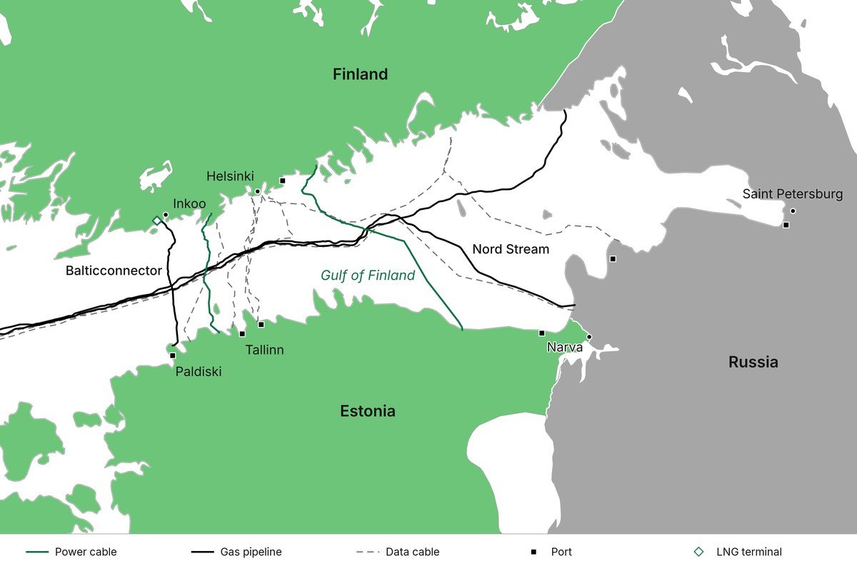
Map: BISC. Routes, ports and borders: OpenStreetMap contributors.
An incident affecting an undersea cable, vessel or navigational system rarely remains the responsibility of a single organisation or country. Maritime authorities, coast guards, navies, infrastructure operators, telecommunications providers, intelligence services and political leadership may all become involved depending on the nature of the disruption. Modern maritime security therefore extends considerably beyond traditional naval operations.
The protection of critical undersea infrastructure illustrates this changing reality. Following repeated incidents affecting energy and communications infrastructure in the Baltic Sea region, NATO launched Baltic Sentry in January 2025 to increase maritime surveillance and improve the protection of critical infrastructure. The operation employs naval vessels, maritime patrol aircraft, drones and national surveillance capabilities while supporting closer cooperation between Allies and national authorities. Baltic Sentry reflects a broader recognition that maritime situational awareness requires military, civilian and commercial actors to operate within a shared information environment.
The Gulf of Finland also demonstrates that maritime access cannot be analysed solely from a military perspective. Congestion or disruption affects commercial shipping, ferry operations, energy systems, industrial supply chains and civilian mobility alongside military considerations. Geography therefore creates a shared operational space regardless of political boundaries.
2.3 The Baltic Sea and North Sea Are Not Separate Systems
Discussions about Baltic security frequently begin and end within the Baltic Sea itself. In practice, the Baltic and North Seas form interconnected maritime systems linked by the Danish Straits and the surrounding transport and logistics networks.
Access into and out of the Baltic Sea passes through a relatively limited southern maritime gateway. Commercial shipping, naval vessels and military reinforcement options must therefore account for the geographical realities of the Danish Straits and the infrastructure supporting maritime movement through Denmark and neighbouring states.
Restricted access through this gateway would have immediate consequences extending well beyond the Baltic States. Baltic ports would experience reduced access westwards while North Sea logistics networks would face limitations moving eastwards. Shipping schedules, insurance costs, commercial operations and port capacities throughout the region would be affected. Naval movement and military sustainment options would require reassessment, while commercial disruption could impact countries not directly involved in the original incident.
Denmark’s geographical position has shaped Northern European maritime strategy for centuries. NATO describes Denmark as both the gatekeeper of the Baltic Straits and a bridge between northern and continental Europe. That description reflects geographical realities rather than political rhetoric. Control of maritime access influences not only military planning but also economic continuity and alliance logistics across the wider northern European region.
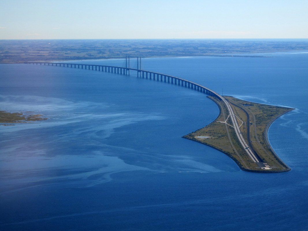
The Øresund Bridge and its artificial island, Peberholm, seen from a plane leaving Copenhagen Airport, September 28, 2015. Photo: Nick-D, CC BY-SA 4.0, via Wikimedia Commons.

The operational significance of the Danish Straits extends far beyond the movement of military forces. Energy supplies, commercial trade and civilian transportation depend upon maritime access between the Baltic and North Seas. Understanding Baltic security therefore requires understanding the wider maritime system of which it forms part.
2.4 Dependence Is Not the Same as Vulnerability
Regional dependencies are often discussed exclusively through the lens of vulnerability. While dependencies introduce risks, they also provide alternatives and increase resilience when properly understood and incorporated into planning.
The Baltic region benefits from multiple ports, maritime routes and operating locations. Sea movement may provide alternatives when land infrastructure becomes constrained. Finland and Sweden contribute additional territory, infrastructure and operational options following their accession to NATO. Allied naval and air presence supports maritime situational awareness, while civilian ferry operators and commercial logistics networks may provide capabilities that can support national and regional continuity planning.
Connectivity therefore creates both opportunities and responsibilities. The existence of infrastructure or commercial arrangements does not automatically guarantee their availability during periods of crisis. A commercially viable ferry route may require legal authorities, additional protection and logistical support before it can contribute to military or civilian contingency planning. Similarly, a port capable of receiving commercial cargo vessels may not possess the equipment, security arrangements or onward transport infrastructure necessary to support military reinforcement operations.
Leadership considerations become particularly important when assessing regional dependencies. Decision-makers must understand whether alternative routes have been identified and exercised, whether legal and political arrangements support their use and whether sufficient capacity exists to sustain both civilian and military requirements simultaneously. Infrastructure resilience is not determined solely by the number of available options but by the ability to employ those options effectively under operational conditions.
The Baltic Sea connects the region in ways that create shared strategic advantages and shared operational challenges. Understanding those relationships is fundamental to understanding how regional security functions in practice. Maritime geography does not merely influence the movement of ships. It shapes the economic, political and military realities upon which regional resilience ultimately depends.
Section 3. Islands, Straits and Geographic Control
Part 1 demonstrated that military geography shapes what is possible on land. Part 2 has already shown that water creates regional dependencies extending far beyond national borders. Islands and maritime chokepoints combine both realities. They are geographical features that influence access, situational awareness, civilian continuity and military operations across considerably larger areas than their physical size might suggest.
Political maps often depict islands as isolated pieces of territory surrounded by water. From an operational perspective, they are frequently part of wider maritime, air and infrastructure systems. Their significance is determined less by their size and more by their geographical position, the infrastructure they support and the functions they enable or constrain.
The Baltic region contains numerous islands, archipelagos and constrained maritime passages that influence how commercial shipping, military movement and regional defence planning are approached. Their importance does not lie solely in their ability to host military capabilities. They influence access, observation, logistics, resilience and the ability to deny or complicate the use of surrounding maritime and airspace by others.
Islands and straits of the Baltic Sea
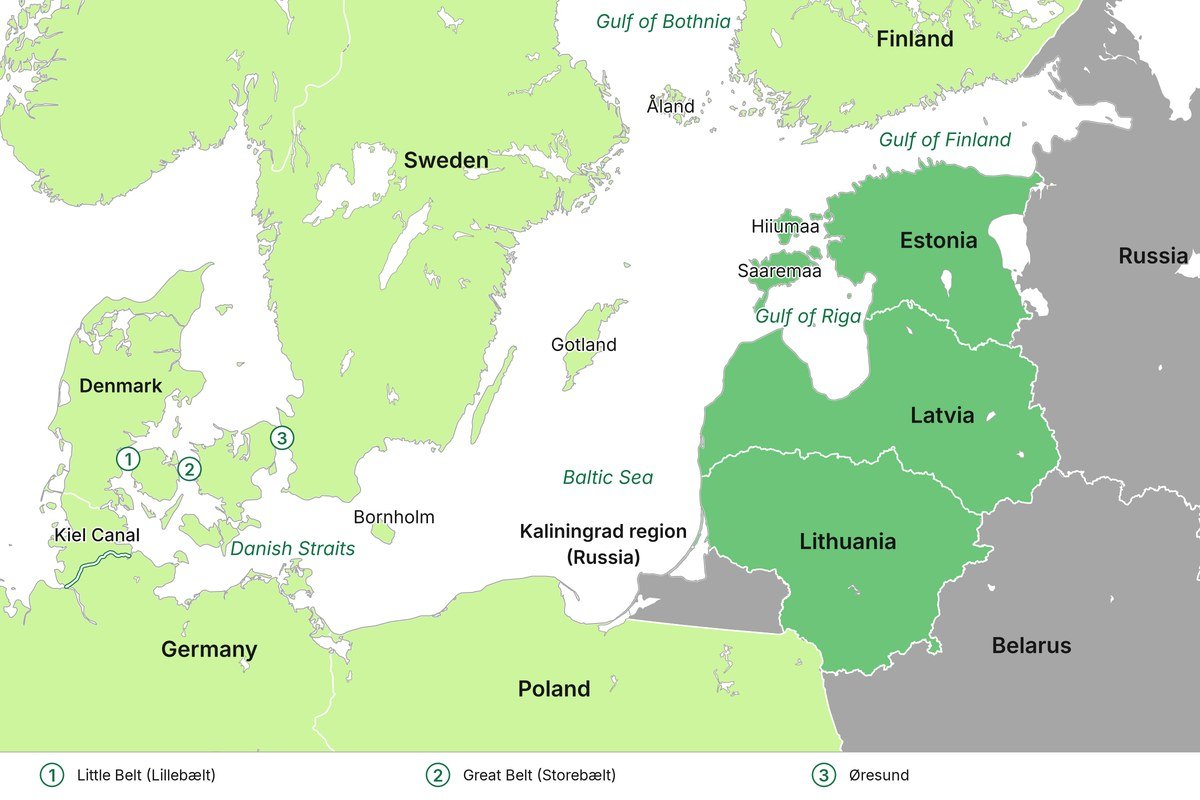
Map: BISC. Borders and the Kiel Canal: OpenStreetMap contributors.
3.1 Islands Are Not Isolated Pieces of Territory
Islands perform a variety of civilian and military functions that are often overlooked in broader discussions about regional security. They may contribute to situational awareness through surveillance capabilities, support air and missile defence systems, provide locations for coastal defence capabilities, enable staging and resupply activities and support both civilian and military maritime movement.
Their operational significance extends beyond military capabilities alone. Islands frequently host ports, airfields, communications infrastructure, navigational systems and transport networks that support civilian populations and commercial activities. During periods of heightened tension or crisis, these same systems may become important components of national resilience and regional contingency planning.
Geographic position creates relevance, but it does not make an island self-sustaining. Ports require protection and maintenance. Airfields require fuel, communications and logistical support. Military capabilities deployed to islands must be supplied and reinforced. Civilian populations require access to food, energy and essential services regardless of whether a crisis is military, environmental or economic in nature.
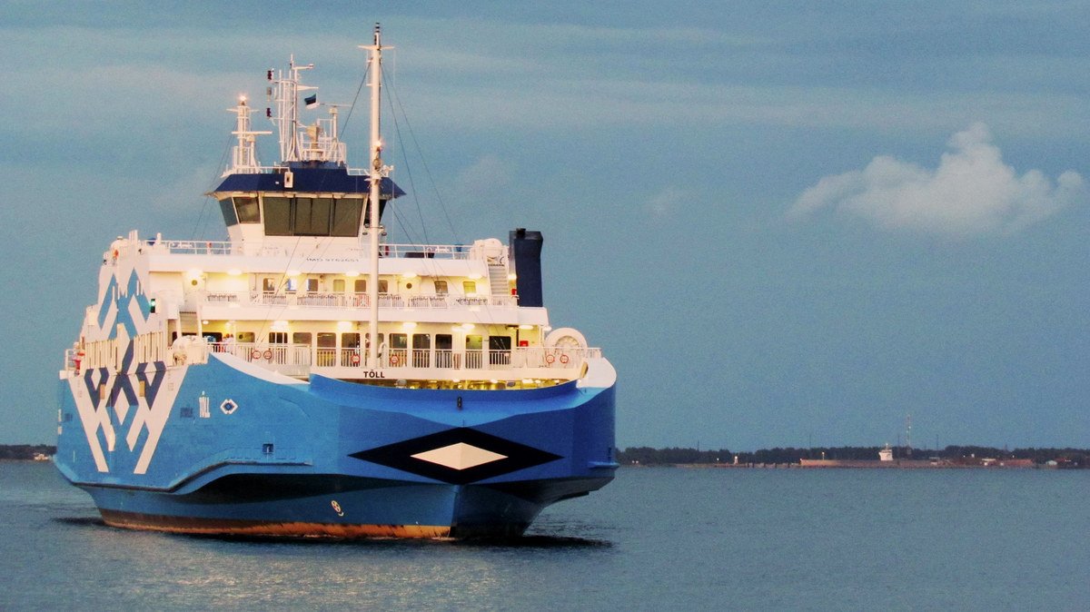
The Estonian ferry Tõll at Kuivastu on Muhu island, August 11, 2018. Photo: Gaetano il marinaio, CC BY 2.0, via Wikimedia Commons.

The operational questions therefore extend considerably beyond whether an island is strategically important. Decision-makers must understand what functions the island supports, which dependencies exist, what infrastructure requires protection and what alternatives remain available should access become constrained. Geography creates possibilities, but infrastructure and planning determine whether those possibilities can be realised in practice.
3.2 Gotland as a Regional Dependency
Gotland has received significant attention in discussions concerning Baltic security, and for good reason. Located in the central Baltic Sea, the island occupies a position that influences maritime and air activity across substantial parts of the region. Its importance, however, is frequently simplified into the assertion that whoever controls Gotland controls the Baltic Sea. While memorable, that formulation does not adequately capture the operational realities involved.
A more accurate assessment is that control of Gotland influences the ability to observe, support, protect and contest activities occurring across the central Baltic maritime and air environment. Its geographical position makes it relevant to surveillance, maritime access, air operations and regional reinforcement considerations. It is one component of a wider operational picture rather than a singular determinant of regional outcomes.
Sweden re-established the Gotland Regiment in 2018 following an assessment of the island’s strategic significance. Swedish defence planning describes Gotland as capable of functioning both as a lock and a key, reflecting its role in influencing movement across surrounding maritime and airspace. Swedish and Polish forces have subsequently conducted exercises involving coastal defence missile systems and the protection of civilian and military supply routes to and from the island.
The practical questions associated with Gotland are operational rather than theoretical. How would contested airspace over the island affect regional movement and surveillance? What would disruption to its ports or airfield mean for both civilian continuity and military operations? How would maritime routes towards Estonia, Latvia and Lithuania be affected if access became constrained? What capabilities are required to sustain and defend the island during a prolonged period of tension or crisis?
Civilian considerations are equally important. Approximately 61,000 people reside permanently on Gotland, and the island depends upon maritime and air connections for commercial activity, supplies and transportation. Any discussion of the island’s strategic significance must therefore include questions concerning civilian resilience and continuity alongside military considerations.
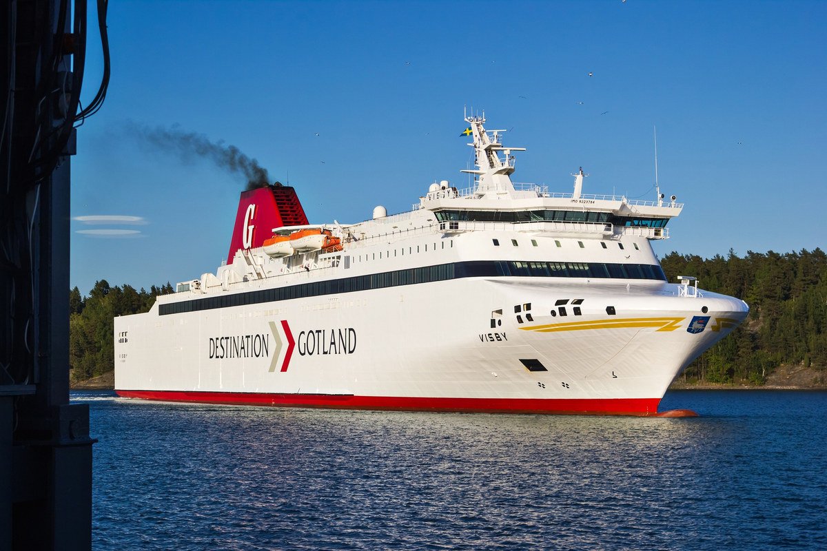
The Destination Gotland ferry Visby arriving at Nynäshamn on the Swedish mainland, June 12, 2016. Photo: Bene Riobó, CC BY-SA 4.0, via Wikimedia Commons.

Gotland’s relevance ultimately illustrates a broader principle applicable throughout the Baltic region. Geographic significance creates dependencies. It does not eliminate them.
3.3 Bornholm, Åland, Saaremaa, Hiiumaa and Other Islands
Gotland is not the only island contributing to regional security considerations. Different islands influence different parts of the Baltic operating environment and perform distinct functions within national and regional planning.
Bornholm occupies an important geographical position near the southern Baltic approaches. Its location contributes to maritime situational awareness and influences activities occurring between Denmark, Germany, Poland and the wider Baltic region. The island has also gained attention in recent years due to the Nord Stream pipeline explosions that occurred in nearby waters, highlighting how civilian and critical infrastructure considerations intersect with maritime geography.
The Åland Islands occupy a unique legal and geopolitical position between Sweden and Finland. Their demilitarised status is governed by international agreements dating back to the nineteenth century and subsequent international treaties. The islands’ geographical location nevertheless influences access and contingency planning within the northern Baltic Sea. Their legal status demonstrates that geography, international law and defence planning frequently intersect in ways that cannot be analysed independently of one another.
Saaremaa and Hiiumaa influence Estonia’s western maritime approaches and contribute to surveillance and access considerations within the Gulf of Riga and surrounding maritime areas. Their geographical positions have shaped military planning throughout history and continue to influence national defence considerations today. Smaller islands and archipelagos throughout the Baltic region similarly contribute to maritime surveillance, navigation, coastal operations and the placement of civilian and military infrastructure.
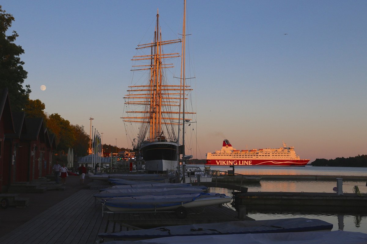
A tall ship and a Viking Line ferry in the West Harbour of Mariehamn on the Åland Islands, June 30, 2015. Photo: Jukka from HELSINKI, Finland, CC BY 2.0, via Wikimedia Commons.

The purpose of examining these islands is not to suggest that every island should be militarised or treated as an independent strategic objective. Their significance lies in understanding the functions they support and the dependencies they create within wider regional systems.
3.4 The Danish Straits as a Regional Hinge
The Danish Straits provide the primary maritime connection between the Baltic Sea and the North Sea. Consisting principally of the Øresund, Great Belt and Little Belt passages, they form one of Northern Europe’s most important maritime gateways for both civilian and military movement.
Commercial shipping entering or departing the Baltic Sea must account for these geographical constraints. Military movement and reinforcement planning are similarly influenced by the availability and security of maritime access through the region. The straits therefore affect not only Denmark but also Sweden, Germany, Poland, Finland and the Baltic States, alongside the wider alliance structures that depend upon access to northern European waters.
The strategic importance of the Danish Straits has remained remarkably consistent throughout history despite technological developments. Maritime access continues to influence trade, logistics and military planning in much the same way that it has for centuries. What has changed are the systems that now depend upon that access. Modern supply chains, energy systems, digital infrastructure and alliance logistics have significantly expanded the operational consequences of maritime disruption.
Civilian maritime traffic density within the region is considerable. Nearby German ports and the Kiel Canal contribute additional logistical significance by connecting maritime and inland transport networks across Northern Europe. Maritime surveillance, mine countermeasure operations, air defence capabilities and host-nation support arrangements consequently form important components of regional planning.
The United Kingdom and Denmark have explicitly recognised the importance of Danish host-nation support arrangements for the timely movement of allied forces across NATO’s northern flank. Access is therefore not merely a geographical consideration but also a political, legal and logistical requirement that depends upon planning, agreements and infrastructure being available when needed.
The Danish Straits illustrate a broader theme running throughout this series. Geography does not simply influence where military operations might occur. It shapes the infrastructure, legal arrangements, political relationships and operational possibilities that determine how regional security functions in practice.
Islands and maritime chokepoints are therefore best understood not as isolated strategic objectives but as components of wider systems that connect national territories, alliance planning and civilian continuity across the Baltic region. Their importance lies not in their individual significance alone, but in the role they play within a highly interconnected northern European operating environment.
Section 4. Reinforcement Depends on Networks, Not One Corridor
Public discussions about Baltic reinforcement frequently rely on simplified visual representations showing forces moving northwards through a single land corridor or arriving from one particular direction. Such illustrations are useful for introducing broad concepts, but they provide very limited insight into how reinforcement actually functions in practice. Reinforcement is not a single movement event. It is a network of political, military, logistical and civilian activities that must operate simultaneously across multiple domains and jurisdictions.
Modern military operations are highly dependent upon sustainment. Personnel, equipment and capabilities cannot simply arrive in theatre and immediately begin operating independently of infrastructure, legal arrangements and support systems. The ability to reinforce a region is therefore determined not only by the availability of military forces but also by the resilience and preparedness of the systems required to receive, move, sustain and protect them.
Understanding reinforcement consequently requires moving beyond questions of geography alone. Political decisions, host nation support arrangements, transportation networks, infrastructure capacity and civilian continuity planning all influence whether military capabilities can be employed effectively.
4.1 Reinforcement Is a Chain of Functions
Every reinforcement plan is dependent upon a series of interconnected functions. Political leaders must first authorise the deployment of forces. Military units must be available at the required level of readiness and transportation assets must be allocated and coordinated across national and alliance structures. Border arrangements, legal permissions and host nation support frameworks must be in place before personnel and equipment can begin moving.
Military movement subsequently depends upon ports, airfields, railways, roads and onward transportation capacity. Reception areas must be prepared to receive personnel and equipment, while fuel, ammunition, maintenance capabilities and communications infrastructure must support sustained operations after arrival. Protection from conventional and non-conventional threats remains necessary throughout the process.
The chain does not end once military capabilities arrive in the region. Forces must continue to be sustained over time while operating within contested environments that may include cyber operations, electronic warfare, attacks against infrastructure and disruptions affecting civilian systems. Reinforcement should therefore be understood as an ongoing process rather than a discrete event.
A delay or failure affecting one part of this chain may influence operational timelines even when military capabilities themselves are fully available. A port operating at reduced capacity, insufficient rail transport, delayed political approvals or damaged infrastructure may all constrain reinforcement efforts despite adequate force availability elsewhere within the alliance.
4.2 Land, Sea and Air Routes Must Be Assessed Together
There is no single Baltic reinforcement route. The region’s geography and infrastructure create multiple pathways for military movement, each with different advantages, limitations and dependencies.
Poland remains essential for land reinforcement into the Baltic States and provides critical transportation infrastructure linking the region with the rest of continental Europe. Finland and Sweden contribute maritime, territorial and airspace options that significantly alter the strategic geography of Northern Europe following their accession to NATO. Denmark and Germany connect the Baltic Sea region to western European logistics networks and provide access to maritime and land transportation systems extending across the continent.
North Sea ports and logistics hubs in countries such as Germany and the Netherlands support the strategic movement of personnel and equipment into Northern Europe. The United Kingdom and Norway contribute to the wider northern flank and provide important links to North Atlantic and Arctic operational considerations. Collectively, these routes and capabilities create flexibility that cannot be represented adequately by a single movement arrow on a map.
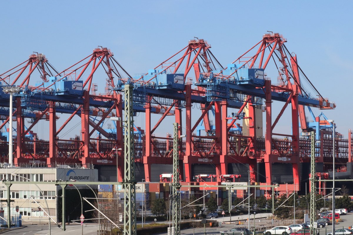
An MSC container ship at the Eurogate container terminal in Waltershof, port of Hamburg, March 30, 2018. Photo: KaiBorgeest, CC BY-SA 4.0, via Wikimedia Commons.

Different transportation methods also perform different functions. Strategic airlift provides speed and flexibility but cannot replace sustained heavy logistics requirements. Maritime transportation remains indispensable for moving significant quantities of equipment and supplies, although it requires functioning ports, maritime access and sufficient protection throughout transit. Land transportation provides onward movement and distribution capabilities but is dependent upon infrastructure capacity and environmental conditions.
Reinforcement planning is therefore fundamentally multi-domain. Military planners assess the combined availability and resilience of land, maritime and air transportation networks rather than relying upon a single geographical corridor or transportation method.
4.3 Infrastructure Capacity Is Not Represented by a Line
Infrastructure is frequently represented on political and military maps as roads, railways, ports and airfields connected by clear and uninterrupted lines. Operational planning requires considerably greater detail.
A road may exist while remaining unsuitable for sustained heavy military traffic. Rail connections may differ in gauge, terminal capacity or the availability of rolling stock. A port may possess adequate water depth for commercial vessels while lacking the cranes, storage facilities or onward transportation capacity required for military logistics. Similarly, an airfield capable of receiving aircraft may not provide sufficient fuel supplies, maintenance facilities, communications capabilities or protective infrastructure to sustain military operations.
Seasonal and environmental conditions further influence infrastructure performance throughout Northern Europe. Local weather patterns, freeze-thaw cycles and maritime conditions may affect transportation networks in ways that are not immediately visible during strategic-level planning. Ferry availability, civilian traffic patterns and infrastructure maintenance schedules similarly influence operational realities.
These details rarely appear in alliance-level presentations or public analyses because they do not aggregate easily into simplified models. Nevertheless, they frequently determine whether plans remain feasible under operational conditions. Infrastructure capacity is therefore not simply a matter of geographical availability. It is a function of technical specifications, legal arrangements, civilian requirements and environmental conditions that vary over time.
The operational questions that emerge are necessarily practical. Which infrastructure is available? What capacity can realistically be sustained? How quickly can damaged systems be repaired or substituted? Which assumptions underpin existing plans? Military geography and infrastructure planning remain inseparable because infrastructure ultimately determines how geography can be utilised.
4.4 Civilian Movement and Military Reinforcement Compete for Capacity
Civilian and military activities frequently depend upon the same infrastructure during periods of heightened tension or crisis. Roads, ferries, ports, fuel systems, communications networks and transportation hubs are designed primarily to support civilian requirements during peacetime. Their capacity is finite and their availability cannot automatically be assumed for military purposes.
Civilian continuity requirements include the movement of emergency services, medical supplies, repair teams and essential commercial goods. National mobilisation efforts require transportation capacity alongside allied reinforcement activities. Local populations may need access to transportation networks depending upon the nature and location of the disruption. Infrastructure operators and civilian authorities must continue maintaining essential services even while supporting defence-related activities.
Planning that assumes exclusive military access to infrastructure overlooks these realities. Reinforcement operations occur within societies that continue to function and within infrastructure systems that must simultaneously support multiple users and competing priorities.
This relationship is particularly relevant within highly interconnected regions such as Northern Europe, where civilian and military transportation networks are closely integrated. Commercial ferry operators, railway companies, port authorities, telecommunications providers and energy companies all contribute directly or indirectly to regional resilience. Their role cannot be separated neatly from broader defence and contingency planning.
Questions concerning civilian evacuation and the prioritisation of transportation capacity warrant separate discussion and will be examined in greater detail in Part 3 of this series. At this stage, it is sufficient to recognise that civilian continuity and military reinforcement are not independent activities. They are frequently dependent upon the same infrastructure and therefore compete for the same resources when demand increases significantly.
Reinforcement in the Baltic region is consequently best understood as a regional network rather than a geographical corridor. Political decisions, infrastructure capacity, host nation support, transportation systems and civilian requirements collectively determine how military capabilities are received, sustained and employed. The ability to move forces remains essential, but movement alone does not create operational effect. Reinforcement becomes meaningful only when the wider network supporting it is capable of functioning under operational conditions.
Section 5. Civilian and Military Dependencies Share the Same Infrastructure
Regional defence planning is frequently discussed in military terms despite the fact that most of the infrastructure upon which military operations depend is neither military-owned nor military-operated. Ports are managed by civilian authorities, ferries are operated by commercial companies, communications networks are owned by telecommunications providers and energy systems are managed by a combination of public and private actors. Civilian infrastructure is therefore not merely adjacent to defence planning. It forms part of the operational environment in which defence and deterrence are expected to function.
The Baltic Sea region is particularly dependent upon interconnected civilian systems that cross national borders and organisational responsibilities. Commercial efficiency has shaped many of these systems over decades through regional integration and market-driven development. The same characteristics that improve connectivity and resilience during peacetime may introduce operational and governance challenges when infrastructure must support military requirements or respond to disruption.
Understanding regional resilience therefore requires examining not only what infrastructure exists, but also who owns it, who operates it, how quickly it can adapt and which legal and political mechanisms govern its use during periods of heightened tension or crisis.
5.1 Ports, Ferries and Commercial Shipping
Ports and commercial shipping networks form an essential component of regional continuity in the Baltic Sea region. Military reinforcement, civilian supply chains, food distribution, industrial production and energy transportation all depend, to varying degrees, upon commercial maritime infrastructure and privately operated services.
Commercial ferry operators maintain critical connections between states throughout the Baltic Sea. Estonia, Finland and Sweden are connected by regular ferry services that transport passengers and freight throughout the year. Major Baltic ports simultaneously support container traffic, bulk cargo, military exercises and civilian transportation. These systems are designed primarily around commercial requirements rather than military contingency planning.
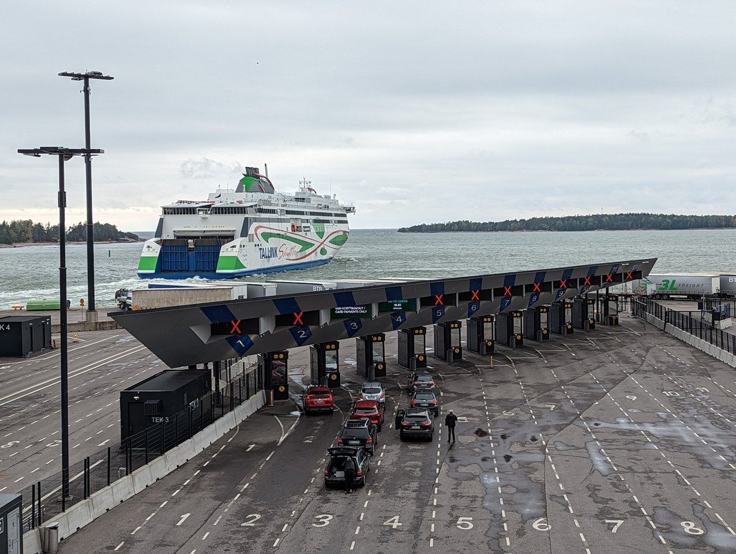
The Tallink ferry Megastar leaving Helsinki’s West Terminal for Tallinn, September 14, 2022. Photo: AleWi, CC BY-SA 4.0, via Wikimedia Commons.

The practical implications are significant. Questions concerning the availability of infrastructure and commercial services cannot be assumed away during operational planning. Decision-makers must understand which capabilities are contractually guaranteed, which depend upon voluntary cooperation and which require political or legal intervention before they can be employed in support of defence-related activities.
Commercial ownership further complicates the operational picture. Ships may be owned in one country, registered in another, operated by multinational corporations and employed across multiple jurisdictions. During periods of escalation, questions arise concerning liability, insurance coverage, contractual obligations and access to personnel and infrastructure. These considerations are neither hypothetical nor administrative details. They influence how quickly capabilities can be made available and which actors possess the authority to prioritise their use.
Leadership considerations extend beyond military requirements alone. Decisions concerning port access and transportation capacity must also account for civilian continuity requirements. Food supplies, medical cargo, energy deliveries and commercial transportation continue to matter during periods of crisis. Infrastructure planning must therefore address how competing demands are prioritised and what alternatives remain available should individual ports or transportation routes become unavailable.
The operational value of ports and commercial maritime infrastructure is consequently determined not only by their physical characteristics but also by the governance arrangements that support their continued operation.
5.2 Energy and Communications
The Baltic Sea region’s energy and communications infrastructure extends across national borders and beneath the sea. Electricity interconnectors, telecommunications cables, pipelines and digital infrastructure collectively support civilian society, government continuity and military activities.
Modern defence planning is increasingly dependent upon systems that were not originally developed for military purposes. Military command and control capabilities depend upon communications networks. Governments depend upon functioning digital infrastructure. Industrial production and logistics require energy systems that operate reliably across national boundaries. Regional resilience therefore relies upon infrastructure that serves civilian, commercial and governmental functions simultaneously.
The incidents involving the Nord Stream pipelines and subsequent damage to communications and energy infrastructure in the Baltic Sea region highlighted both the interconnectedness and complexity of these systems. They also demonstrated that responsibility for critical infrastructure protection is distributed across national governments, private companies, military organisations and international institutions.
In response to these developments, both NATO and the Joint Expeditionary Force have increased their focus on maritime surveillance, infrastructure protection and regional information sharing. The JEF activated its first response option to enhance protection of critical undersea infrastructure, while NATO launched Baltic Sentry in early 2025 to improve maritime situational awareness and support the protection of critical infrastructure across the region.
The significance of these initiatives lies not only in the capabilities employed but also in what they reveal about the operational environment. Critical infrastructure protection is no longer exclusively a civilian or military responsibility. Effective responses increasingly require cooperation between infrastructure owners, national authorities, military organisations and international partners operating within different legal and institutional frameworks.
Energy and communications systems therefore illustrate how regional dependencies extend beyond traditional defence planning. Their disruption has implications for civilian continuity, government operations and military effectiveness simultaneously.
5.3 Repair Capacity Is Part of Resilience
Discussions concerning critical infrastructure protection often focus on surveillance and deterrence. These capabilities are important, but resilience depends equally upon the ability to restore functionality when disruption occurs.
Protecting every kilometre of cable, pipeline and communications infrastructure continuously is neither practical nor economically feasible. Resilience planning must therefore account for what happens after an incident has occurred. Detection capabilities, attribution support and situational awareness remain important, but they are only part of the broader recovery process.
Specialised repair vessels and crews are required to restore undersea infrastructure. Spare components must be available and accessible. Regulatory and contractual arrangements influence how quickly repairs can begin, while access to damaged sites may depend upon weather conditions, maritime traffic and legal permissions. Alternative routes and redundancy measures determine whether services can continue while restoration efforts are underway.
Recovery planning also requires prioritisation. Not all systems can necessarily be restored simultaneously. Governments and infrastructure operators must therefore consider which services are essential for civilian continuity, which are necessary for defence and which alternative arrangements exist during periods of disruption.
These considerations are operational rather than technical in nature. The ability to restore critical infrastructure rapidly contributes directly to regional resilience. Recovery capacity should therefore be treated as an integral component of preparedness rather than an activity that begins only after disruption has occurred.
5.4 Shared Infrastructure Creates Shared Political Decisions
Critical infrastructure incidents rarely align neatly with national borders or organisational responsibilities. An undersea cable may be located within the territorial waters of one state while serving customers in several others. The affected infrastructure may be owned by a commercial consortium, while the vessel involved is foreign-owned and operating under a different legal jurisdiction. Responding to such incidents frequently requires political coordination alongside technical and operational expertise.
Questions concerning jurisdiction, attribution and legal authority emerge quickly when multiple states and organisations are affected simultaneously. Information sharing arrangements, thresholds for political action and the involvement of military organisations must often be determined under time pressure and within evolving circumstances.
The Baltic Sea region provides numerous examples of infrastructure systems that create shared political and operational responsibilities. Energy interconnectors, communications networks and maritime transportation systems are inherently transnational in character. Their protection and restoration therefore depend upon cooperation across national and institutional boundaries.
Governance consequently becomes a component of regional resilience. Infrastructure can only contribute effectively to defence and continuity planning if political and legal arrangements support timely decision-making and operational coordination. Technical capabilities remain important, but they cannot compensate for uncertainty concerning responsibilities or authorities when incidents occur.
Civilian and military dependencies in the Baltic Sea region are deeply interconnected because they rely upon the same infrastructure, the same people and, increasingly, the same information environment. Understanding these relationships is essential for assessing how regional resilience functions in practice. Defence planning cannot be separated from civilian continuity when both depend upon the same systems and the same decisions.
Section 6. Technology Changes How Dependencies Are Observed and Contested
Technology has significantly expanded the ability of states and alliances to observe, analyse and respond to developments across the Baltic Sea region. Maritime and air activity that once required individual platforms operating within limited geographical areas can now be monitored through a combination of national capabilities, commercial services and multinational information-sharing arrangements. Advances in sensing technologies have improved situational awareness across domains, but they have also introduced new dependencies related to data ownership, governance and decision-making.
Technology should therefore be understood as part of the wider operating system rather than an independent solution. Sensors do not produce operational effect on their own. Their value depends upon the ability to interpret information accurately, share it appropriately and integrate it into timely political, civilian and military decision-making processes.
The Baltic Sea region illustrates this particularly well because it combines dense commercial activity, critical infrastructure, multiple national jurisdictions and increasing technological sophistication within a relatively constrained geographical environment.
6.1 Persistent Sensing Changes the Maritime Picture
Persistent sensing has fundamentally changed how maritime activity can be observed across Northern Europe. Satellites, coastal radars, automatic identification systems, maritime patrol aircraft, crewed vessels and increasingly autonomous platforms contribute to a significantly more comprehensive understanding of activity occurring above, on and beneath the sea.
Modern maritime situational awareness combines information from military, civilian and commercial sources. Commercial satellite imagery providers offer capabilities that were previously available only to governments. Coastal surveillance systems provide continuous monitoring of maritime traffic. Automatic Identification System (AIS) data allows authorities to track commercial vessel movements, while acoustic and seabed sensors contribute to the protection of critical undersea infrastructure. Maritime patrol aircraft and naval vessels continue to provide essential capabilities for identification and response, particularly when activity requires direct observation or legal intervention.
The increasing availability of commercial and publicly accessible maritime data has also changed the broader information environment. Researchers, journalists and private organisations are often capable of identifying unusual maritime activity independently of governments. This development contributes positively to transparency and situational awareness, but it also increases the importance of verification and responsible interpretation.
Artificial intelligence and machine learning capabilities are increasingly being employed to identify anomalies and improve maritime surveillance. These technologies offer significant potential when analysing large volumes of data generated by multiple sensors operating simultaneously. Their usefulness, however, remains dependent upon the quality of the underlying data and the processes supporting operational decision-making.
Persistent sensing improves awareness only when information can be shared, correlated and acted upon effectively. Increasing the number of sensors without improving governance and decision-making processes risks generating additional alerts without necessarily improving operational outcomes.
6.2 Autonomous Systems Expand Coverage but Not Authority
Autonomous and remotely operated systems have become increasingly important contributors to maritime and multi-domain operations. Air, surface and underwater drones offer opportunities to expand surveillance coverage, increase operational flexibility and improve the protection of critical infrastructure across geographically dispersed areas.
NATO’s Task Force X Baltic initiative demonstrated this potential during exercises conducted in 2025, where approximately 70 autonomous systems were tested in the Baltic Sea environment. In 2026, eight Baltic Sea Allies agreed to accelerate the integration of technology-enabled multi-domain capabilities to improve maritime situational awareness and infrastructure protection. NATO has identified improved detection capabilities and enhanced situational awareness as key operational benefits of these efforts.
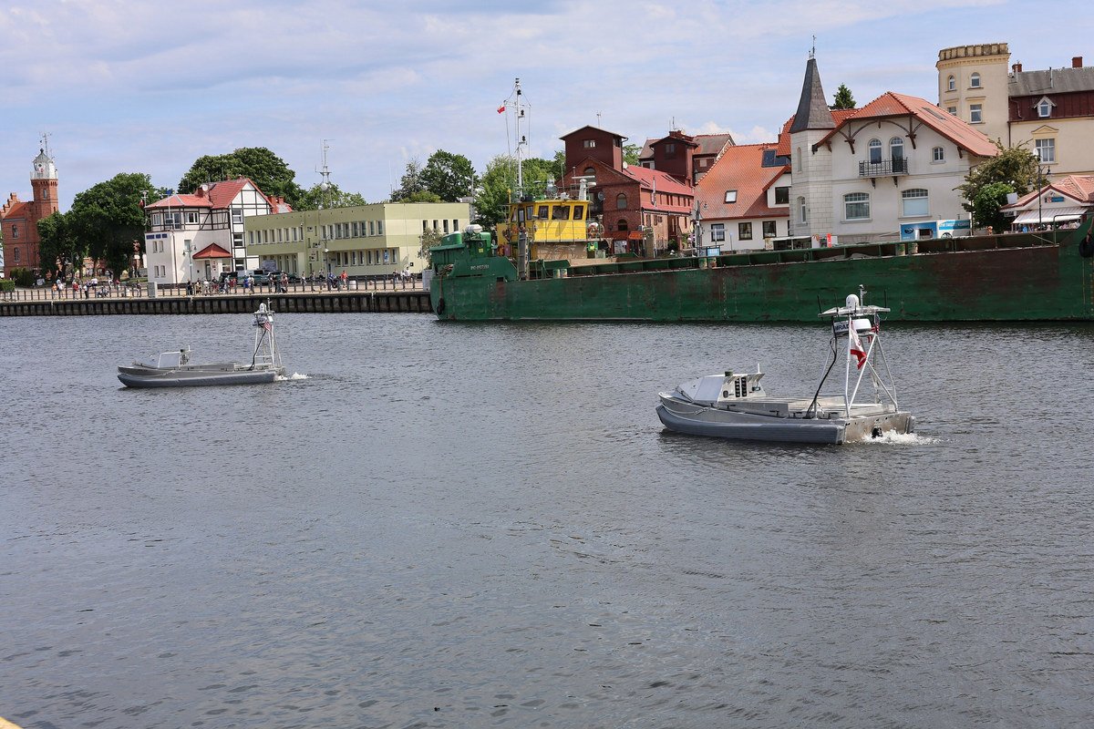
Two autonomous reconnaissance craft on the Słupia river at Ustka, Poland, before a swarm exercise during BALTOPS 2026, June 7, 2026. Photo: Chief Petty Officer Sandi Grimnes Moreno, public domain, via Wikimedia Commons.

The advantages offered by autonomous systems are significant but should not be overstated. They increase coverage and provide additional options for surveillance and data collection. They do not replace political authority, legal responsibility or operational decision-making.
Practical limitations remain relevant. Weather conditions influence the performance of autonomous systems operating in Northern Europe throughout the year. Communications infrastructure remains essential for many platforms, while endurance limitations affect their ability to provide persistent coverage. Data quality and the identification of unusual or potentially malicious activity continue to require human expertise and contextual understanding.
Legal and institutional considerations are equally important. Detecting an anomaly does not automatically determine its significance or establish who possesses the authority to respond. Military organisations, coast guards, maritime authorities and civilian infrastructure operators frequently operate under different mandates and legal frameworks. Autonomous systems may identify activity of interest, but they do not determine whether an incident constitutes an accident, criminal activity, hybrid operation or a matter requiring political consultation.
Technology therefore expands operational possibilities without reducing the need for governance, legal clarity and human judgement.
6.3 The Regional Data Problem
The Baltic Sea region does not suffer from a lack of information. The more difficult challenge lies in integrating information originating from multiple organisations operating within different national and institutional frameworks.
National authorities maintain their own situational awareness systems. NATO possesses alliance-level capabilities and information-sharing mechanisms. The Joint Expeditionary Force contributes regional expertise and flexible cooperation arrangements. Civilian infrastructure operators maintain data concerning their own systems, while commercial organisations provide valuable maritime and satellite information. Together, these capabilities create significant opportunities for improving regional awareness.
The challenge is transforming information into timely operational effect.
Several practical questions remain relevant when considering regional information sharing and operational coordination. Who owns the information collected by different organisations? Who may access it and under what conditions? Which system or organisation provides the authoritative operational picture during periods of uncertainty? How are commercial restrictions and intellectual property considerations addressed when privately generated data becomes operationally relevant?
The distinction between classified and unclassified information presents additional complexities. Commercial satellite imagery may identify unusual maritime activity before governments publicly acknowledge it. National authorities may possess classified information that cannot immediately be shared with civilian infrastructure operators or international partners. Effective regional responses therefore require mechanisms capable of integrating information across different security classifications and organisational boundaries.
Operational timelines also matter. Detecting an anomaly represents only the beginning of a broader process. Information must be analysed, attributed where possible and communicated to the appropriate authorities. Legal responsibilities must be clarified and political or operational decisions must follow when required. The speed with which information moves through these processes frequently determines whether technological capabilities contribute meaningfully to regional resilience.
Technology has fundamentally improved the ability to observe and understand developments across the Baltic Sea region. It has not eliminated the organisational and governance challenges associated with acting upon that information. Regional resilience depends not only upon the technologies employed but also upon the institutions, processes and relationships that determine how information becomes operationally useful.
Technology changes capability. Governance determines whether that capability creates timely and effective operational outcomes.
Section 7. NATO, JEF and the Problem of Fragmented Regional Execution
The Baltic Sea region is supported by multiple defence and security frameworks because no single organisation is designed to address every aspect of regional security. Collective defence, critical infrastructure protection, political consultation, maritime surveillance, civilian preparedness and crisis response all involve different mandates, capabilities and decision-making mechanisms. The existence of multiple frameworks is therefore neither unusual nor problematic in itself.
The challenge lies in ensuring that these frameworks complement one another operationally. Regional security benefits when organisations provide cumulative effect through clearly defined responsibilities, shared situational awareness and rehearsed coordination mechanisms. Difficulties emerge when plans develop in parallel, capabilities are announced without integration into wider structures or institutional handovers remain insufficiently defined.
The Baltic operating environment is increasingly characterised by activities that sit across traditional organisational boundaries. Maritime incidents may involve civilian infrastructure, military assets, commercial operators and political authorities simultaneously. Questions concerning regional resilience therefore cannot be answered exclusively through military planning or institutional mandates. Effective regional security depends upon understanding how national, regional and alliance-level structures interact in practice.
Nato and the Joint Expeditionary Force
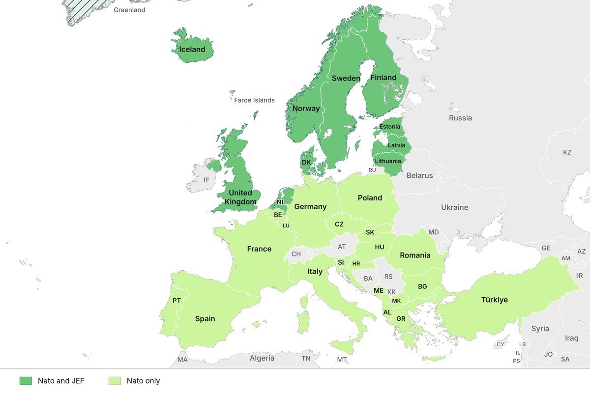
Map: BISC.
7.1 NATO Provides Collective Defence Authority and Scale
NATO remains the cornerstone of collective defence within the Baltic Sea region. Its regional defence plans, command structures and standing military capabilities provide the political authority and military scale required to support deterrence and defence across the Alliance.
NATO’s responsibilities include regional defence planning, command and control arrangements, forward deployed forces, air policing and air defence activities, standing naval forces, reinforcement planning and common standards that enable interoperability between Allies. Exercises conducted across the Alliance provide opportunities to test military capabilities and improve readiness while strengthening cooperation between participating states.
Recent initiatives such as Baltic Sentry further demonstrate NATO’s increasing focus on protecting critical infrastructure and enhancing maritime situational awareness within the Baltic Sea region. The Alliance’s ability to operate across multiple domains and coordinate collective defence activities remains one of its principal strengths.
The accession of Finland and Sweden has significantly altered the strategic geography of NATO’s northern flank. Their membership contributes additional military capabilities, infrastructure and operational options across Northern Europe. It has also improved opportunities for regional planning and interoperability throughout the Baltic Sea and Nordic regions.
Membership alone, however, does not resolve every practical challenge associated with regional defence. Infrastructure capacity, host nation support arrangements, command relationships and readiness requirements continue to require sustained investment and planning. Interoperability is not achieved solely through institutional membership but through continuous cooperation, exercises and the development of common operational understanding.
NATO provides the authority and scale necessary for collective defence. The effectiveness of that authority nevertheless depends upon how national capabilities, infrastructure and supporting organisations are integrated within wider regional planning.
Split commands in the middle of high risk areas can cause wider situational awareness and response problems
7.2 JEF Provides Regional Familiarity and Flexible Response Options
The Joint Expeditionary Force occupies a different role within the regional security architecture. It is not a standing military formation or a substitute for NATO. Rather, it is a flexible, United Kingdom-led framework that enables participating states to consult politically and combine capabilities when appropriate.
The International Centre for Defence and Security characterises the JEF as a framework through which the United Kingdom and participating states may contribute capabilities for specific activities or operations. Its flexibility allows members to cooperate across a range of scenarios without requiring the involvement of all participants or the activation of formal collective defence mechanisms.
The potential value of the JEF lies in its regional familiarity and its ability to facilitate cooperation across the Baltic Sea, High North and North Atlantic. Participating states share significant experience operating within these environments and possess complementary perspectives concerning regional security and resilience.
The framework supports political consultation, flexible responses to emerging situations and the integration of military and non-military instruments when appropriate. Its geographical focus also provides opportunities to address issues that may remain below the threshold of conventional conflict while nevertheless requiring coordinated regional responses.
Activities involving critical infrastructure protection, maritime surveillance and regional exercises illustrate the practical benefits of maintaining flexible cooperation mechanisms alongside NATO’s collective defence structures. The JEF is therefore best understood as one component of a broader regional architecture rather than an independent operational solution.
The relationship between NATO and the JEF should not be viewed as competitive or duplicative. Their respective strengths lie in different mandates, capabilities and political arrangements. The operational challenge is ensuring that these differences contribute to regional resilience rather than institutional complexity.
7.3 The Handover Problem
Modern security challenges do not always develop according to organisational boundaries. Maritime incidents, hybrid activities and disruptions affecting critical infrastructure frequently evolve gradually and may involve multiple national and international actors before becoming matters of wider alliance concern.
This raises practical questions concerning institutional handovers and operational responsibilities. What occurs between national responses and NATO-led activities? When does regional cooperation through frameworks such as the JEF provide additional value rather than introduce another layer of coordination? Which organisation maintains the shared operational picture during the transition from incident management to crisis response?
Questions concerning legal authorities and political mandates are equally important. National governments retain primary responsibility for activities occurring within their jurisdictions, yet incidents affecting shared infrastructure may simultaneously influence several states. Civilian infrastructure owners may possess essential information or capabilities that military organisations do not control. Determining responsibilities and authorities during rapidly evolving situations therefore requires prior planning rather than ad hoc arrangements.
The JEF’s policy direction explicitly recognises that contemporary security challenges increasingly blur traditional distinctions between peace and war, home and abroad, and state and non-state activities. It also acknowledges the importance of integrating military capabilities with wider governmental instruments when responding to developments occurring below the threshold of conventional conflict.
The operational implications of these observations are significant. Maintaining a shared situational picture across organisations requires more than technical interoperability. It requires common terminology, agreed responsibilities and mechanisms for transferring information and authority as circumstances evolve.
Exercises frequently demonstrate that individual capabilities function effectively in isolation. They do not always test how organisations interact when incidents transition across political, legal and operational thresholds. Questions concerning who leads, who supports and how decisions are communicated remain fundamental to regional preparedness.
7.4 Fragmentation Is an Operational Risk
Fragmentation should not be understood simply as institutional complexity. Multiple organisations and frameworks are often necessary because regional security challenges are themselves complex. Fragmentation becomes an operational risk when responsibilities overlap without coordination or when institutional boundaries impede effective cooperation.
Operational fragmentation may emerge in various forms. Different organisations may maintain separate operational pictures while employing different terminology and reporting mechanisms. National caveats may influence the availability of capabilities or information. Technical systems may remain incompatible despite supporting similar functions. Infrastructure owners and civilian authorities may be insufficiently integrated into contingency planning.
Exercises occasionally test individual components of regional preparedness without examining how the wider system performs under realistic operational conditions. Capability announcements may generate expectations that exceed the supporting infrastructure, sustainment arrangements or legal authorities required to employ them effectively. Institutional plans may assume cooperation without adequately defining the mechanisms through which that cooperation will occur in practice.
The leadership implication is not that additional organisations or frameworks are necessarily required. The Baltic Sea region already benefits from substantial institutional capacity and political commitment. Greater value may instead be achieved through clearer interfaces between existing structures, rehearsed handovers, named responsibilities and measurable readiness across organisational boundaries.
Regional resilience depends not only upon the capabilities available but also upon the ability of institutions and organisations to employ those capabilities coherently. Defence planning in Northern Europe increasingly requires military, civilian and political actors to operate as components of a connected regional system. The effectiveness of that system is determined less by the number of organisations involved than by how successfully they coordinate their activities when circumstances demand it.
Section 8. Local Knowledge Is an Operational Capability
Regional security discussions frequently focus on military capabilities, infrastructure and institutional arrangements. Less attention is often given to a capability that is considerably more difficult to acquire, transfer or replace: local knowledge. Military geography is not limited to what can be observed on maps or measured through satellite imagery. It also includes an understanding of how infrastructure functions in practice, how environmental conditions influence mobility and how societies respond during periods of disruption or crisis.
This knowledge is rarely visible in strategic-level documents, yet it routinely influences operational outcomes. It is accumulated over decades through experience, planning, exercises and daily interaction with the environment in which military and civilian systems operate.
8.1 Knowledge That Does Not Travel Cleanly
Some forms of knowledge are exceptionally difficult to aggregate into regional or alliance-level planning products without losing important context.
Military planners may need to understand which port becomes operationally constrained during winter conditions or which ferry operators are capable of supporting heavy military transport. Infrastructure specialists may know which sections of road networks are affected by spring thaw or where civilian traffic bottlenecks routinely emerge during periods of increased movement. Municipal authorities understand local responsibilities and legal processes that influence access to infrastructure and emergency response arrangements.
Critical infrastructure operators possess detailed knowledge regarding cable landing stations, energy systems and technical dependencies that are not immediately visible from publicly available data. National authorities understand which legal permissions can be granted rapidly and which require political or administrative processes that may take considerably longer than operational planning assumptions anticipate.
Local knowledge also extends beyond physical infrastructure. Understanding how local populations respond to mobilisation measures, recognising historical and societal sensitivities and identifying information narratives that may influence public behaviour are equally important components of regional preparedness.
These details rarely survive aggregation into strategic-level presentations because they are highly contextual. They nevertheless influence whether plans remain operationally feasible once implementation begins.
8.2 Smaller Allies Are Knowledge Holders, Not Terrain Providers
Smaller allies are sometimes discussed primarily in terms of geography or military capabilities. Such perspectives overlook one of their most important contributions to regional security: local and regional understanding.
The Baltic States, Finland, Sweden, Denmark and other regional actors do not merely provide territory upon which allied operations may occur. They possess detailed knowledge of the geography, infrastructure, institutions and operating environments that shape regional security. They understand what constitutes normal activity within their respective environments and are often best positioned to recognise developments that require closer examination.
Local knowledge contributes directly to military planning, infrastructure resilience and situational awareness. It informs assumptions concerning mobility, logistics, civilian continuity and institutional coordination. Centralised assessments and multinational intelligence capabilities are indispensable for understanding broader strategic developments, but they cannot generate local understanding after a crisis has already begun.
Regional resilience therefore depends upon combining local expertise with alliance-level capabilities and broader strategic assessments. Neither can substitute effectively for the other.
8.3 Leadership Responsibilities
Local knowledge contributes meaningfully to regional preparedness only when it is incorporated early enough to influence planning and decision-making.
Leaders should therefore ask whether national, municipal and commercial experts are involved when assumptions are defined rather than after plans have already been developed. Exercises should provide opportunities for regional actors to challenge planning assumptions and contribute local expertise instead of merely validating centrally developed concepts.
Questions concerning infrastructure ownership, civilian continuity and legal responsibilities similarly require the participation of the organisations that manage these systems on a daily basis. Commercial operators, infrastructure providers and local authorities are frequently essential contributors to regional resilience and should be treated accordingly within planning processes.
Institutional memory presents an additional leadership challenge. Personnel rotate regularly across military, governmental and multinational organisations. Local knowledge must therefore be documented and transferred in ways that preserve operational context without reducing it to generic lessons learned.
Military geography cannot be understood independently of the people and institutions that operate within it. Regional security is strengthened not only by the capabilities that allies bring to the Baltic Sea region, but also by their willingness to recognise that local knowledge is itself an operational capability that deserves to be integrated, exercised and sustained over time.
Conclusion
Part 1 of this series demonstrated that political borders do not adequately explain military geography. Rivers, lakes, wetlands, infrastructure and environmental conditions influence operational realities in ways that are rarely visible on political maps. Part 2 expands that perspective by demonstrating that national borders also do not contain the consequences of disruption. Geography creates dependencies that extend across states, institutions and domains throughout Northern Europe.
The Baltic Sea region is connected through maritime routes, ports, energy systems, communications infrastructure, airspace and political arrangements that support both civilian continuity and military operations. These systems do not operate independently of one another. A disruption affecting a cable, port, ferry connection or maritime chokepoint has implications that frequently extend well beyond the location in which the incident occurred. Similarly, decisions concerning reinforcement, resilience and preparedness are rarely national questions alone. They are regional questions that require regional understanding.
Interdependence should not be interpreted as either a strategic weakness or a guarantee of resilience. Connected systems create opportunities for redundancy, flexibility and cooperation, while simultaneously creating shared exposure and operational dependencies. The strategic value of regional integration therefore depends less on the existence of connections and more on whether those connections are understood, diversified, protected and regularly exercised under realistic conditions.
Modern defence planning increasingly requires military organisations to understand civilian infrastructure, commercial realities and political processes alongside traditional military considerations. Ports are not merely maritime infrastructure. Islands are not simply geographical features. Undersea cables are not exclusively technical systems. Each contributes to a wider regional operating environment in which military, civilian and commercial activities are deeply interconnected.
One of the recurring themes throughout this series is that geography continues to shape operational possibilities despite technological and institutional developments. Military geography matters because it influences movement and mobility. Strategic geography matters because it determines how regions are connected and where dependencies emerge. Technology matters because it changes how these dependencies are observed and contested. Governance matters because it determines whether capabilities create operational effect when they are required most.
The Baltic States are not isolated territories waiting for reinforcement from elsewhere. They are part of a connected regional system whose geography creates both operational options and shared exposure. Serious analysis must therefore examine not only where forces are located, but also how access, information, infrastructure, political authority and sustainment connect the region as a whole. The Baltic theatre begins well before the eastern border and extends considerably beyond the Baltic Sea itself.
Part 3 will examine what military operations and reinforcement actually require in practice, why simplistic movement assumptions often fail to capture operational realities and why every arrow drawn on a map conceals thousands of assumptions concerning logistics, infrastructure, decision-making and contested multi-domain operations.
Sources Used in This Article
NATO
- NATO Baltic Sentry (January 2025 announcement)https://www.nato.int/
- NATO Maritime Security and Critical Undersea Infrastructure resourceshttps://www.nato.int/cps/en/natohq/topics_136233.htm
- NATO Allied Maritime Command (MARCOM)https://mc.nato.int/
- NATO Task Force X Baltic and Multi-Domain Maritime Innovation materialhttps://www.act.nato.int/
Joint Expeditionary Force (JEF)
- Joint Expeditionary Force Leaders’ Statement (2026)https://www.gov.uk/government/collections/joint-expeditionary-force
- Joint Expeditionary Force Policy Direction documentationhttps://www.gov.uk/government/publications/joint-expeditionary-force-policy-direction
- UK Ministry of Defence - Joint Expeditionary Force overviewhttps://www.gov.uk/government/groups/joint-expeditionary-force
Baltic Sea Critical Infrastructure
- NATO Baltic Sentry
- Nordic-Baltic critical infrastructure announcements
- European Commission Critical Entities Resilience frameworkhttps://commission.europa.eu/
- EU Critical Infrastructure Protection materialhttps://home-affairs.ec.europa.eu/
Maritime Infrastructure and Shipping
- Danish Maritime Authorityhttps://dma.dk/
- Finnish Transport Infrastructure Agencyhttps://vayla.fi/en
- Swedish Transport Administrationhttps://www.trafikverket.se/en/
- Estonian Transport Administrationhttps://transpordiamet.ee/en
- Port of Rotterdamhttps://www.portofrotterdam.com/
- Port of Hamburghttps://www.hafen-hamburg.de/en/
- Port of Gothenburghttps://www.portofgothenburg.com/
- Port of Tallinnhttps://portoftallinn.com/
Recommended Reading
Baltic Sea Security
- ICDS publicationshttps://icds.ee/en/
- Baltic Defence College publicationshttps://www.baltdefcol.org/
- Swedish Defence Research Agency publicationshttps://www.foi.se/en.html
- Finnish Institute of International Affairshttps://www.fiia.fi/en
- Royal Swedish Academy of War Scienceshttps://kkrva.se/
- NATO Defence Collegehttps://www.ndc.nato.int/
Northern European Security and Defence
- Danish Institute for International Studieshttps://www.diis.dk/en
- Norwegian Institute for Defence Studieshttps://www.forsvaret.no/en/organisation/norwegian-defence-university-college/institutes/institute-for-defence-studies
- RUSIhttps://rusi.org/
- RAND Europehttps://www.rand.org/randeurope.html
- CSIS Europe Programhttps://www.csis.org/programs/europe-russia-and-eurasia-program
Maritime Security and Infrastructure
- Centre for Naval Analyseshttps://www.cna.org/
- European Maritime Safety Agencyhttps://www.emsa.europa.eu/
- Baltic Sea Action Grouphttps://www.bsag.fi/en/
Books Worth Reading
Baltic Sea and Northern Europe
- Michael North - The Baltic: A History
- Michael Roberts - The Swedish Imperial Experience 1560-1718
- Norman Davies - Vanished Kingdoms
- Lawrence Freedman - Strategy: A History
- Hew Strachan - The Direction of War
- Colin Gray - Modern Strategy
- Edward Luttwak - Strategy: The Logic of War and Peace
Military Geography
- Yves Lacoste - La Géographie, ça sert, d’abord, à faire la guerre
- Colin Flint - Introduction to Geopolitics
- Geoffrey Sloan - Geopolitics, Geography and Strategic History
- Gray and Sloan - Geopolitics, Geography and Strategy
Maritime Strategy
- Alfred Thayer Mahan - The Influence of Sea Power Upon History
- Geoffrey Till - Seapower
- Milan Vego - Joint Operational Warfare
Museums and Places Worth Visiting
Sweden
- Swedish Army Museum (Stockholm)https://armemuseum.se/en/
- Swedish Naval Museum (Karlskrona)https://www.marinmuseum.se/en
- Gotland Military History Museumhttps://www.gotlandsmuseum.se/
Finland
- Suomenlinna Fortresshttps://www.suomenlinna.fi/en/
- Forum Marinum (Turku)https://www.forum-marinum.fi/en/
- Military Museum of Finlandhttps://www.sotamuseo.fi/en/
Estonia
- Estonian War Museumhttps://esm.ee/en/
- Seaplane Harbourhttps://meremuuseum.ee/lennusadam/en/
- Narva Museum and Hermann Castlehttps://narvamuuseum.ee/en/
- Coastal Folk Museum (Prangli)https://rannarahvamuuseum.ee/
Denmark
- Danish War Museumhttps://natmus.dk/museer-og-slotte/krigsmuseet/
- Danish Maritime Museumhttps://mfs.dk/en/
Poland
- Museum of the Second World War (Gdańsk)https://muzeum1939.pl/en
- Polish Maritime Museumhttps://nmm.pl/en/
Norway
- Norwegian Armed Forces Museumhttps://www.forsvaretsmuseum.no/
- Norwegian Maritime Museumhttps://marmuseum.no/en
Previous Article in the Series
The Baltic Reality: Beyond the Red Arrows – Part 1: Military Geography
LinkedIn article:
LinkedIn discussion post:
The Baltic Sea region is best understood by visiting it. Geography, infrastructure, weather, distances and maritime realities are difficult to appreciate fully from conference slides and political maps. Many of the places listed above are not only historically significant but remain highly relevant for understanding contemporary security and defence discussions in Northern Europe.
Eva Sula is an independent defence and security strategic advisor specialising in NATO and European defence cooperation, regional security, emerging technologies and operational capability development. She is a NATO DIANA Defence Mentor, a Senior Fellow for Estonia at the Council on Strategic and Foreign Intelligence (CSFI), and a member of The Alphen Group.
© Eva Sula
First published on LinkedIn on July 24, 2026. Read the original article or the LinkedIn post.
All opinions expressed are those of the author alone and may not represent those of the institutions they represent or the Baltic International Security Centre (BISC). BISC maintains a strict intellectual independence policy across all its projects and publications.